Do 2005 The year citizen Vitaliy Aronov-Tyuntsev gave the museum a sheet from A.M book. MALLS. “Description of the universe” With the inscription above De l'Europe. Fugure 36. Poland (inv. White 1071).
The book was published in Paris 1683 year. As it is known at this time in Ukraine hetman Ivan Samoilovich and may have been familiar with this edition. Interesting to see how our lands imagined at the time in the West.
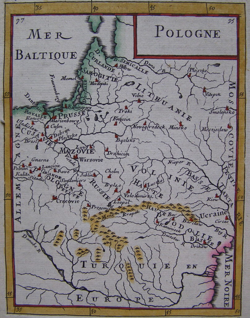
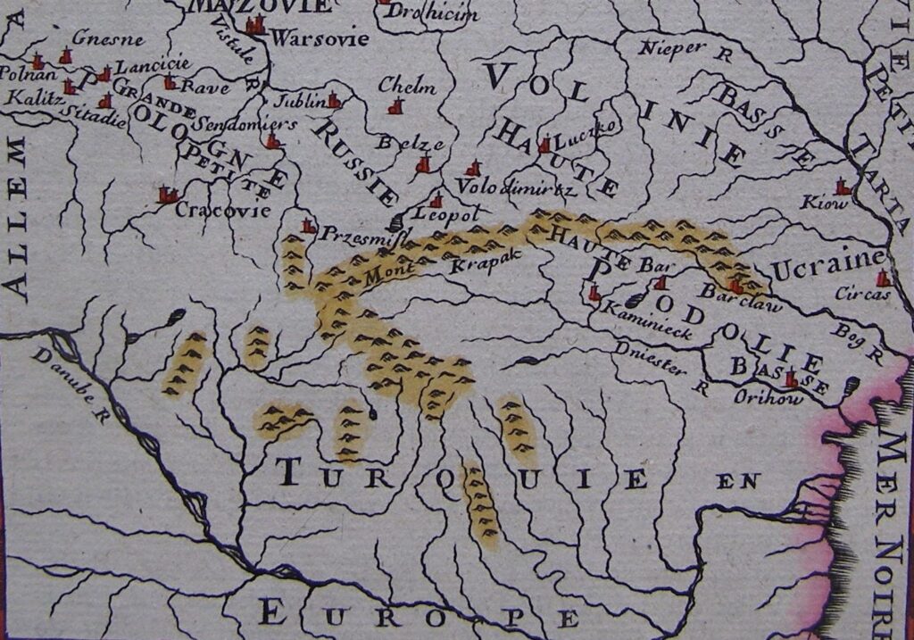
On with. 95 The frame depicts a map of European territory from Poznan to Smolensk, From the Gulf to the Black Sea. Volyn is marked from Ukrainian lands, Podillya, Red Rus (called haute Russia), Kyivshchyna (called Ucraine), partly left -bank Ukraine (named Petite Tartarie); From the rivers - Dniester, Deer, Pripyat, Дніпро (The last two are identified), Right; from cities - Kyiv, Cherkasy, Bratslav, Кам’янець-Подільський, Луцьк, Vladimir-Volynsky, Lviv, Have. The frame is painted with light brown and red paints, Carpathian Mountains-light brown paint.
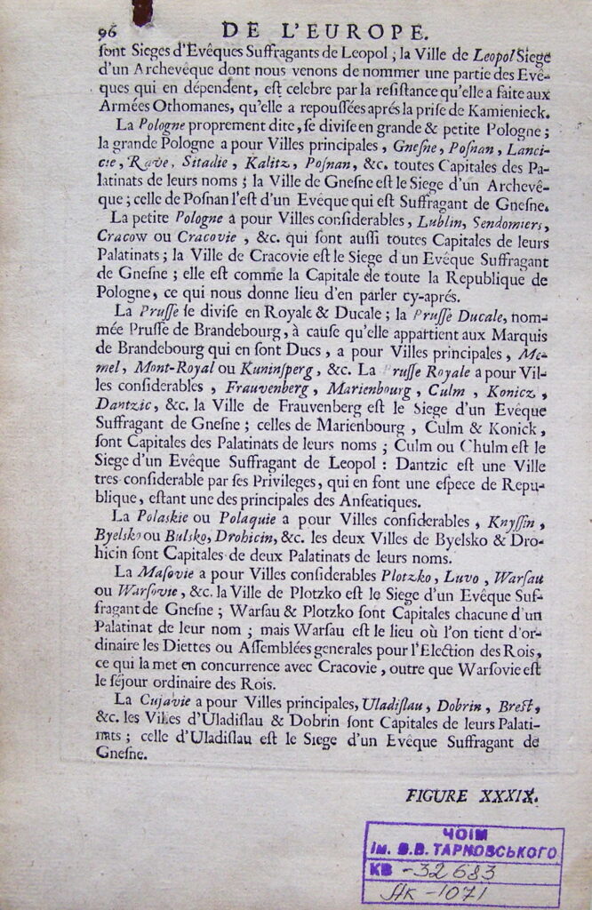
On with. 96 The characteristics of the components of the Commonwealth and the main cities - Lviv are presented in French., Nesting, Poznan, Lublin, Sandomira, Krakow, Memel, Kenigsberg, Marienburg, Bully, PLOTSKA, Warsaw, Brest, etc.. As for the end of the XVII century. Europeans were well informed about the geography of Ukraine, at least the right bank.
Старший науковий співробітник музею,
кандидат історичних наук Ігор Ситий
More Stories
Chernihiv State Museum II. In the former Silbank
Burnt villages of Chernihiv Oblast: memory, which cannot be lost
“Stories of the unbreakable: Tupychiv community”